
Caledonia Neighbors by Public Source
Each source answers a narrow block question. Racine County GIS shows the shape and position of parcels. Tax and assessment records connect a parcel with owner and mailing fields. A deed documents a recorded transfer. MyVote is designed for a person or single-address voter lookup, not a neighborhood roll. Association pages describe communities, but the reviewed sources do not expose complete member lists.
| Public source | What it adds to a block | How to access it |
|---|---|---|
| Racine County GIS and ArcGIS | Parcel geometry, parcel ID, site address, roads, and map links | County map or public data service |
| Tax Inquiry and Ascent | Owner, mailing and site fields, sales, tax, and parcel details | Free county and village-linked search |
| Register of Deeds | Transfer parties, dates, documents, plats, and surveys | LandShark, TriMin, public computer, or copy request |
| MyVote Wisconsin | Permitted voter information for a known person or address | Individual lookup; protected fields omitted |
| Community and HOA pages | Public subdivision identity, rules, amenities, and civic context | Public pages; member channels may be gated |
An owner name does not establish who occupies a home. The tax mailing address may point elsewhere, and a permit applicant may be a builder or agent. Use exact labels such as owner, grantee, applicant, or public association contact. Never turn those roles into an unsupported list of Caledonia neighbors.
Map the Caledonia Block
The adjacent-parcel method starts at one known property and moves only to parcels that the map actually shows nearby. The Racine County parcel layer exposes PARCELID, SITEADDRESS, and MapBookLinks fields. Its service supports geometric searches and pagination, with a maximum record count of 1,000. Narrow the map or query so the result represents the intended block.
- Standardize the target address, then find its site address in county GIS or Tax Inquiry.
- Save the target parcel ID. Inspect the polygons that touch it or sit directly across the road.
- Record each adjacent parcel ID separately. Open the matching Tax Inquiry or Ascent result for official owner and site fields.
- Use the Register of Deeds when a transfer, plat, or survey answers the question. Keep recording dates with each result.
- Add village Planning or Engineering context for a subdivision, road project, wetland, floodplain, or land-use question.
The official parcel-service query screen shows the available fields, geometry controls, output formats, and result limits.
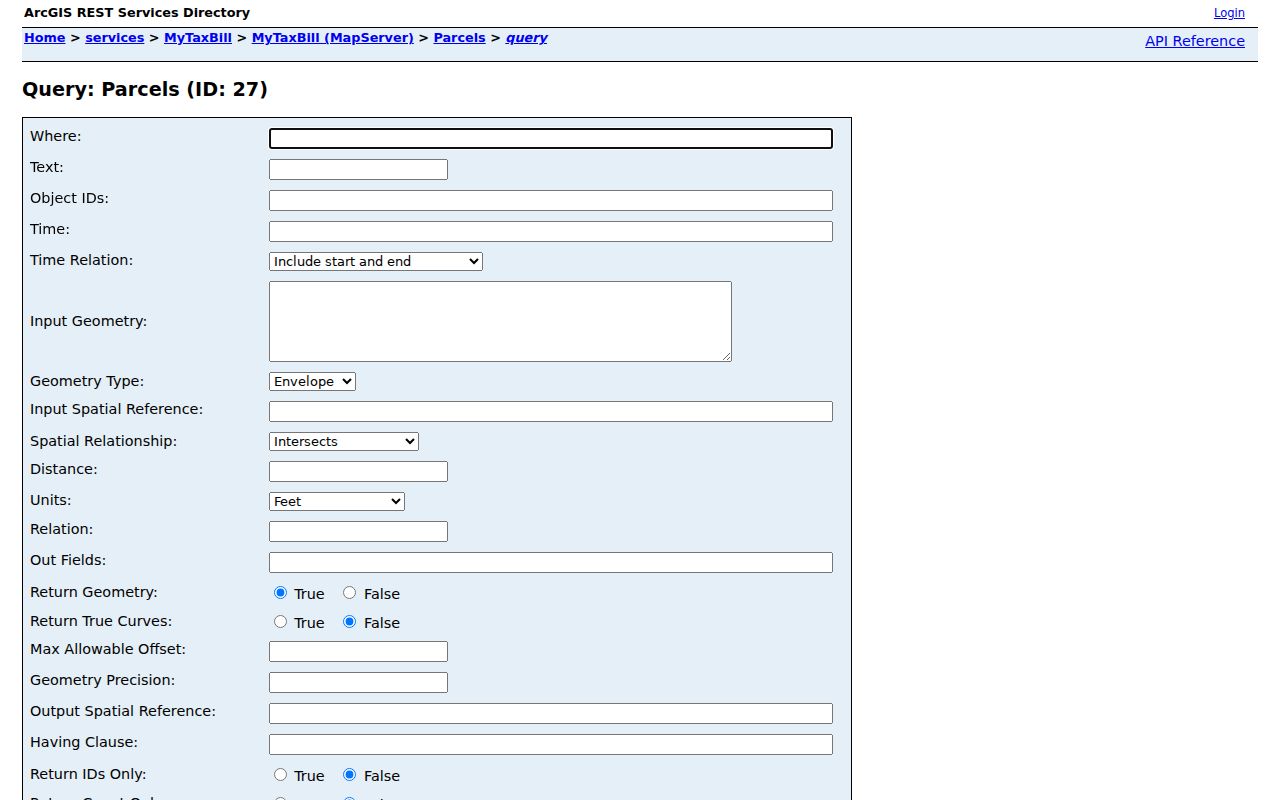
It supports a map-based comparison, but it does not turn parcel data into proof of a household or relationship.
Read Caledonia Parcel Fields Carefully
Site address, mailing address, and legal description mean different things. A site address is the physical location assigned to the parcel. A mailing address is where tax or owner correspondence goes. The legal description identifies the land in a recorded instrument. One record can display all three, yet none alone proves that an owner lives there.
- Adjacent parcel
- A separately identified tract whose mapped boundary touches or lies near the target parcel.
- Parcel ID
- The county identifier used to connect tax, map, and some recorded-document searches.
- Situs or site address
- The physical address attached to the land, which can differ from a mailing address.
- Recorded plat
- An official map of lots, blocks, easements, and subdivision details filed with the recorder.
A county GIS boundary is useful for research, but a legal survey or recorded plat controls when mapped geometry and an on-the-ground line seem inconsistent. Floodplain, wetland, zoning, road, and district layers describe place. They do not describe the people on that land.
Note: Use the full recorded deed when a tax-bill legal description is abbreviated; the parcel card is not the complete instrument.
Caledonia Neighborhood Association Layers
No complete official directory of Caledonia neighborhood associations was found. Public sources instead show historical communities, municipal boards, subdivisions, civic organizations, and volunteer history groups. These categories stay separate because none is a general resident roster.
Prairie Pathways
The public HOA page describes a conservation subdivision east of I-94 with trails, prairie, a pond, and play areas. Its member channels are private or gated.
River Meadows II
The public subdivision page provides covenants, bylaws, and financial statements. Discussions and contact information require member access.
Racine Neighborhood Watch
This civic organization links residents and law enforcement. It does not publish a verified roster of Caledonia neighbors.
Village Boards
Public agendas and appointments document government roles. A meeting appearance or application is not proof of residence.
Prairie Pathways' public landing page shows the line between open subdivision context and private member communication.
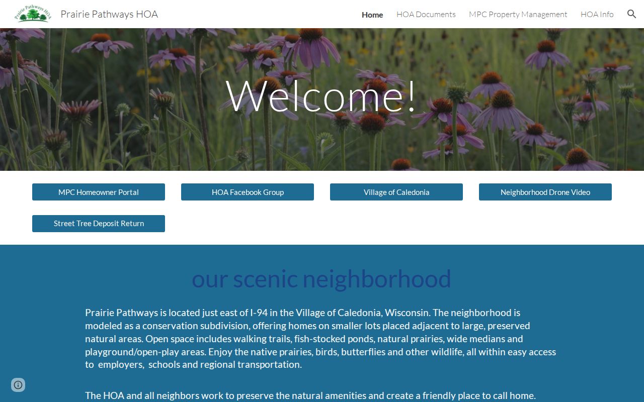
Use the public description to understand the subdivision, then stop at the gated portal rather than seeking private names or contact details.
Old Names Around Caledonia Neighbors
Caledonia's official history names Sterns Crossing, Lamberton, Willow Creek, Tabor, Linwood, Ives Station, North Racine, Kilbournville, Skunk Grove, Husher, and Thompsonville. These are historical communities and place clues, not modern neighborhood boundaries. A deed, newspaper, or directory may use one even when the current parcel says Village of Caledonia.
Ives Station offers a useful local example. Its railroad and stone-crushing history can explain a track, industrial parcel, old road, or business reference that does not fit a modern subdivision name. Around Linwood, Root River and Highway 38 are stronger clues. Tabor connects Bohemian settlement history with Tabor Road and Douglas Avenue.
Roads and waterways can split what looks like one neighborhood on a mailing label. I-94, Highway 41, Highway 38, Five Mile Road, former rail corridors, and the Root River all help orient a historic place. They are not substitutes for parcel geometry. Check the current county map before calling two addresses adjacent, especially near a village edge or a large rural tract.
Village history also preserves the Husher and Hoosier spelling story. Search both forms when needed, then test the result against a dated map or parcel. Do not infer that everyone tied to an old place name was a neighbor in today's sense.
Caledonia Block Plans and Plats
The Village Planning and Zoning Department holds site-plan, subdivision, condominium-plat, zoning, variance, planned-unit development, and land-use records. Planning moved from Racine County to the village in May 2019. Older project material may remain with a county office, while later files may be in village custody.
Village Engineering links the public county GIS and handles land development, roads, wetlands, floodplains, permits, and projects. Building packets may contain surveys, setbacks, elevations, grading, drainage, and erosion-control details. Those documents can explain when a block changed. A named applicant still may be an owner, builder, designer, or agent rather than an occupant.
When no portal exposes the needed plan, request a date-bounded record from the likely custodian. Include the parcel ID, subdivision or project name, street, document type, and preferred format. Ask which office held the file before or after the 2019 transition.
Caledonia Voter Records Stay Individual
MyVote Wisconsin accepts first name, last name, and birth date for a voter search. Its address route uses street, unit, city, and ZIP. It is built for permitted information about a known voter or address, not browsing every registered person on a Caledonia block. Wisconsin does not register voters by party.
Protected fields and confidential voter addresses are omitted under Wisconsin law. A statewide voter-file request follows a different process, with fees and protected-data rules. Do not scrape MyVote or convert individual results into a neighborhood list.
At village edges, one block can cross a postal city, ZIP, district, or municipal boundary. Use the county parcel municipality and geometry with the exact address. A Racine postal label does not by itself place a property inside the City of Racine.
Compare Caledonia Neighbor Tools
Official records and commercial neighbor tools have different proof value. The public custodian identifies the source, field meaning, and update context. A commercial compilation may merge old addresses, relatives, phone data, and names without showing how or when the link was made.
| Question | Official public records | Commercial compilation |
|---|---|---|
| Where did the fact come from? | Named county, village, or state custodian | Source may be unclear or blended |
| What does an address mean? | Labeled as site, mailing, voter, or recorded address | Address types may be merged |
| How can it be checked? | Open the current record or ask the office | Correction path may be limited |
| Does it prove occupancy? | No; it proves only the stated record role | No; a compiled association is not proof |
For Caledonia neighbors, use the official record closest to the question. Date-stamp the result and keep doubt visible. That avoids turning a stale address into a false claim about the block.
Privacy Around Caledonia Neighbors
Public parcel data does not open private household, utility, delivery, membership, or contact records. Wisconsin DOJ Safe at Home provides substitute addresses and mail forwarding for qualifying people at safety risk. Voter and court systems also withhold protected data. If an official system hides an address, do not use other records to reconstruct it.
Lawful use. Learn about a Caledonia block without watching, exposing, threatening, or harassing anyone; Wisconsin statutes §§ 940.32 and 947.013 apply.
Public safety, court, police, voter, and registry data should not be combined into a dossier on nearby people. Proximity does not prove a family tie, shared conduct, or any personal similarity. When the goal expands to a whole named road, use the Caledonia street directory workflow and keep the same source limits.